|
These images were created using LiDAR, an airborne mapping technique that uses laser technology to record very
small differences in surface topography.
Light Detection and Ranging (LiDAR) technology involves a powerful
laser, sensor, precision airborne global positioning system (GPS), an inertial measurement unit (IMU) and
specialized software. The laser and sensor heads are operated in a portal through the underside of an aircraft.
Laser pulses are emitted very rapidly (50,000+ per second) and the sensor measures both the timing and intensity
of returns from strike points on the terrain or other features below. The result is a point cloud from which the
primary raw datasets are extracted. These datasets, usually refered to as digital elevation models (DEM), include
bare earth and canopy/built feature elevations.
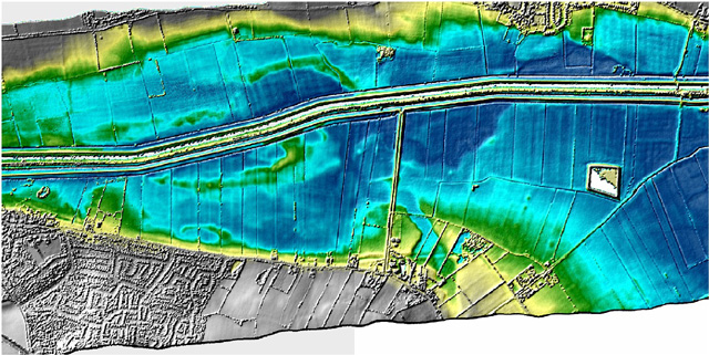
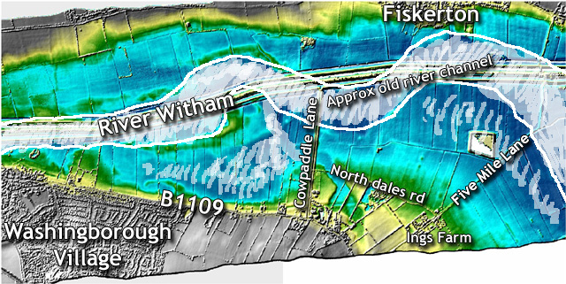
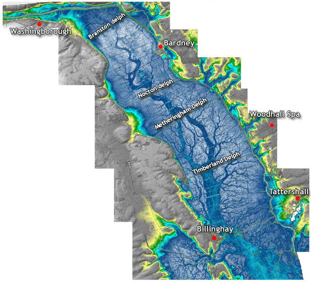
In the first image, the green and yellow shading of the
higher ground clearly picks out banks of former courses of the River Witham. Distinct circular mounds are probably
Bronze Age barrows located on the banks along both sides of the river.
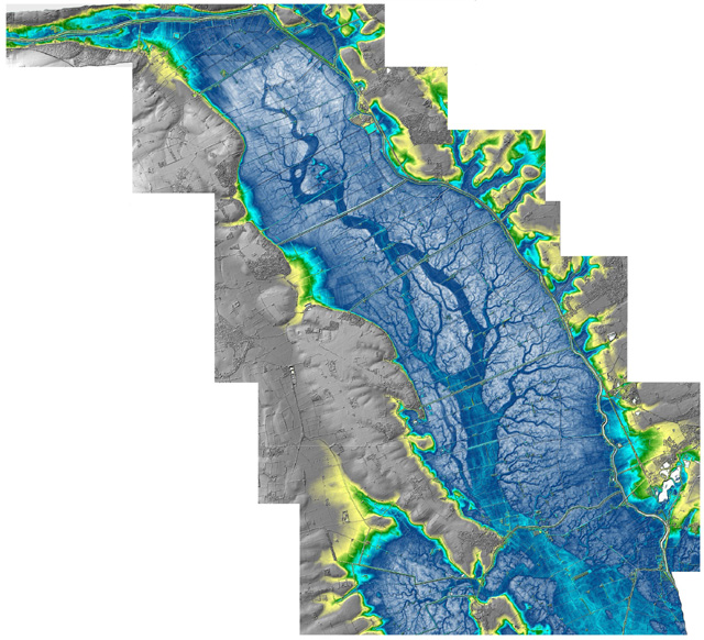
The most striking feature of the
second image is the dendritic system of former channels that now occur as ridges of slightly higher ground,
demarcated by the darker blue and turquoise colours. From around 6,000 to 4,000 years ago, this whole area was an
estuary. The channels are the remains of the estuarine creek system, which infilled with sands and silts as the
tidal waters advanced and retreated
|